
New Haven Block Neighbor Sources
A New Haven block search stacks records that use different keys. GIS shows parcel shape, Vision is the property reference, SearchIQS is the land-record index, and tax search follows a bill or location. Voter records show electors. NHFPL adds older address lines, while CMT adds meeting context. These sources give neighbors different kinds of evidence, but none is a complete list of occupants.
| Source | What It Shows About a Block | Access |
|---|---|---|
| New Haven ArcGIS viewer | Parcels, dimensions, streets, layers, adjoining lots | Free dynamic viewer; popup controls vary |
| Vision New Haven assessor | Owner/co-owner, situs/mailing, value and physical fields | Free reference; assessor fallback |
| City Clerk/SearchIQS | Deed parties, dates, legal description, maps, parcel history | Guest index; image/certified-copy routes differ |
| New Haven tax search | Property location, owner or bill number, tax trail | Online, in-person, and mail routes |
| CitySquared/Municity | Permit or certificate chronology and public names | Dynamic portal, terminal, or FOIA fallback |
| Connecticut voter lookup | Registered name, address, district, party/status, participation | Web, Registrar, or restricted file request |
| NHFPL reverse directory | Historic address-to-name, business, and occupation clues | Ives reference collection; address sections about the 1920s onward |
| Community Management Team | Areas, meetings, map, chairs, and city specialists | Public umbrella; no private roster located |
| Maps and history collections | Ward, Sanborn, streetscape, and older block context | City, LOC, NHFPL, Museum, and Yale holdings |
Read results by role and date. A parcel card can identify a titled owner, but the mailing address may be elsewhere. A voter record identifies a registered elector, not everyone in the home. A directory line may be a household head, business, office, or past occupant. Matching a name across dated records is a lead, not proof of current residence.
Note: New Haven County is a geographic label only, so current land and voter records route through city offices rather than a county counter.
Map New Haven Neighbor Parcels
New Haven's adjacent-parcel method starts with geometry, not a name list. Open the city's GIS Gallery and ArcGIS viewer, zoom to the address, and turn on parcel or dimension layers. Click the target polygon, then save its link, legal location, cross streets, and any popup identifier before comparing neighbors by parcel.
The New Haven Parcel Dimensions map service is the source shown in the image below. Its service page identifies the New Haven Parcel Dimensions map and Dimensions layer.
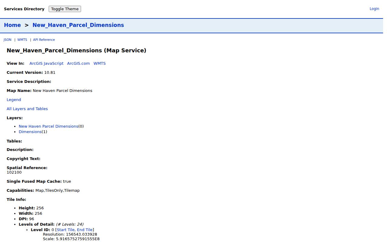
The service is a cached Web Mercator map covering New Haven. It gives parcel context, not a deed, survey, or list of occupants.
- Locate the address and note the map or access date.
- Click the target parcel and record its popup, link, legal location, dimensions, and situs.
- Pan north, south, east, west, and across the street. Save each parcel key, or repeat its address in Vision.
- Compare each owner's mailing address with the mapped situs.
- Use SearchIQS or the City Clerk for a legal lot, prior deed, or certified copy. The full street chain belongs in the New Haven street directory.
A live radius, buffer, measure, export, or pagination control was not confirmed. Use only map-browse and click behavior, and preserve the URL and nearby parcel identifiers for repeat research.
Compare New Haven Parcel Cards
Vision Government Solutions is New Haven's property reference for owner-name, address, and parcel research. Its welcome screen confirms the entry control and 2021 state-mandated revaluation. The inner form loads dynamically, so confirmed modes and gaps both matter.
| Field or control | Type | Required | Confirmed limitation |
|---|---|---|---|
| Owner name | Text/search | Not exposed | Supported; partial-match rules were not captured. |
| Property or situs address | Text/address | Not exposed | Supported after entering the database. |
| Parcel or account key | Text/search | Not exposed | Format and label were not located. |
| ZIP filter | Filter/text | Not exposed | Screen captured; counts and behavior unconfirmed. |
| Sort, print, pagination | Results | Not exposed | Do not promise whole-block browsing or export. |
Read a result card as an assessment record, not a list of who is home. The Connecticut parcel schema includes town, owner, co-owner, location, mailing address, values, physical attributes, sale fields, and collection dates. It is statewide planning data, not a promise that every field appears on a New Haven card.
- Situs address
- The mapped location of the parcel, used to place a lot beside other lots.
- Mailing address
- The address used for owner or tax correspondence. It may be elsewhere.
- Parcel key
- A property identifier that can connect GIS, assessor, tax, deed, and map records when exposed.
Assessment dates matter. New Haven's previous assessment was October 1, 2016; the 2021 revaluation reflects October 1, 2021 fair market value; and a 2026 cycle is noted. A current value and historic deed sale date answer different questions.
Note: A mailing address can place an owner elsewhere, so use the mapped situs when comparing parcels on the same block.
Confirm New Haven Abutters
GIS adjacency shows which parcels touch or face one another, but deeds and maps provide the legal check. New Haven land records are held by the City Clerk, not a county recorder. SearchIQS supplies the online index and images, while its Map Index by Street can help when an old address lacks a modern owner name.
Start with the parcel or owner in Vision. Search that owner as grantee in SearchIQS, inspect the instrument, then move backward through the grantor. Match book/page, date, lot or block, legal description, and prior references before treating two parcels as one.
- Save owner, parcel key, situs, mailing address, assessment year, and legal location.
- Search the owner as grantee. Record roles, instrument type, date, book/page, consideration if shown, and legal description.
- Search the seller as prior grantee. Compare lot, block, bounds, subdivision, and map references.
- Use the street map index, releases, liens, or maps to resolve a split or changed label.
- For older or certified records, contact the City Clerk at 200 Orange Street, Room 202, or use library, archive, Museum, or FOIA access.
Current SearchIQS help gives land records from July 26, 1951 through the present and maps from January 1, 1835 through the present. An older PDF gives August 18, 1952 for land records and a 1978 image split. Note the source date. Guest index searching is free; images can require an account or a $2 download or print charge.
- Grantor and grantee
- The grantor transfers an interest; the grantee receives it. The roles set search direction.
- Legal description
- Lot, block, bounds, subdivision, map, or book/page language that keeps a parcel trail intact.
- Abutter
- A parcel or owner identified as adjoining. It is not automatically the current occupant.
New Haven Voter Records Nearby
Connecticut voter records add a dated civic-registration clue, not a block census. New Haven Registrars maintain the local list, and the state lookup is the official online endpoint. Exact web fields were not exposed, so do not promise a street-wide display for neighbors or a particular result layout.
The public file can include name, residence address and ZIP, district, party, active/inactive status, birth year, and participation, subject to release rules. Month and day of birth are exempt under PA 26-1 section 96; driver-license and Social Security identifiers are not public. A record never shows ballot choice.
- Use the New Haven Registrar of Voters for registration, canvass, elections, and statistics.
- The office is listed at 200 Orange Street, Room 201, with phone 203-946-8035 and weekday 9 to 5 hours.
- If the lookup does not answer a block question, request the full file from the Secretary of the State by mail or e-mail.
- The route costs $300 for a CSV and requires requester details and a permitted-purpose certification.
The certification restricts harassment, advertising, solicitation, sale, marketing, reproduction, and similar misuse. ACP participants and voters covered by the state privacy program can have street or house information suppressed. A missing name may reflect protection, not a bad parcel match.
New Haven Neighborhood Geography
New Haven's block vocabulary has more than one layer. The Nine Square Plan centers the Green, while Ninth Square, Wooster Square, and Fair Haven add east-side context. East Rock, Westville, Dwight/West River, Newhallville, the Hill, East Shore/Annex, and Beaver Hills/Edgewood/Whalley are neighborhood labels, not legal parcel boundaries.
The city's published Community Management Team page says all are welcome and publishes meetings, locations, chairs or specialists, and a map. It is a public umbrella, not a private membership list; use the linked city page in the source table when you need its current details.
| Neighborhood or area | CMT contact route | Useful block context |
|---|---|---|
| Downtown / Wooster Square | CMT listing; meetings, map, contacts | Green and historic-square context |
| Westville | CMT listing; meetings, map, contacts | Street and civic context |
| Dixwell | CMT listing; meetings, map, contacts | Block and corridor context |
| Hill North / Hill South | CMT listing; meetings, map, contacts | Address and meeting route |
| Dwight / West River | CMT listing; meetings, map, contacts | Block and district context |
| Newhallville | CMT listing; meetings, map, contacts | Neighborhood and corridor context |
| East Rock | CMT listing; meetings, map, contacts | Street and block context |
| Fair Haven | CMT listing; meetings, map, contacts | East-side community context |
| Quinnipiac East / Fair Haven Heights | CMT listing; meetings, map, contacts | East-side address context |
| East Shore / Annex | CMT listing; meetings, map, contacts | Shore and Annex context |
| Whalley / Edgewood / Beaver Hills | CMT listing; meetings, map, contacts | West-side street context |
Commercial-district names such as Chapel West, Westville Village, Grand Avenue, State Street, East Grand/Quinnipiac, Wooster Square, West River, and Long Wharf/Sargent can orient a block. They are not association boundaries. Let the parcel map and legal description control property.
Note: Neighborhood names help orient a search, but a recorded lot description controls a property boundary.
Official and Commercial Neighbor Tools
Official records and paid compilations can look similar, but they answer different questions. A New Haven assessor card, deed index, voter list, or GIS parcel has a custodian and record date. A commercial report may merge public indexes and purchased data. Breadth does not make it current or official.
- Official local and state records
- Start with the GIS viewer, Vision, City Clerk, Registrar, court clerk, or library. These sources identify the record type, date, redactions, and route for a correction or certified copy.
- Commercial record compilations
- These services may merge names, addresses, and dates. Reports can be stale, wrongly merged, or missing protected or sealed material. A fee does not create official status, and a private opt-out does not remove the underlying record.
For block curiosity or family history, return to the source that created the entry. Keep the access date, query address, parcel key, and record role. This helps distinguish a moved owner, business entry, old directory line, or suppressed voter record.
New Haven Permits and FOIA
CitySquared/Municity is New Haven's current public route for parcel permits and applications. The city says applications are electronic, paper applications are not accepted, and office terminals or kiosks are available. A result may show work date, address, applicant, contractor, permit, or certificate fields, but the exact controls were not captured. Older material may be offline.
The Connecticut Freedom of Information Act compilation shown below is the statewide law reference for a written request when a block record is not searchable.
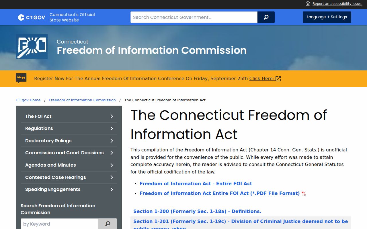
The captured page identifies the Act and section links. New Haven's online form accepts e-mail, mail, fax, online, telephone, printed-copy, or in-person delivery choices; detailed request fields load dynamically.
Anyone may request a record orally or in writing. The city encourages its form, reviews exemptions and redactions, and may clarify. Use FOIA or an office terminal for a missing permit or older certificate. A May 13, 2026 FOI Commission decision involving CitySquared makes completeness a current issue, so preserve the URL and request date.
Note: A searchable permit portal can still leave older records to an office terminal, a custodian request, or the FOIA process.
New Haven Memory Map
Formal records are not the only way to understand a New Haven block. The NHFPL Local History Room holds Neighborhood Research material, maps, manuscripts, newspaper microfilm, and directories. The New Haven Museum adds photographs, drawings, scrapbooks, and local organization records. These sources explain a block's name, institution, or building shape without becoming a current resident list.
The NHFPL/Yale Memory Map is a community-memory route identified March 16, 2026 for uploading, digitizing, and preserving local photographs and documents. Check current submission and rights terms. It complements, but does not replace, a deed, assessor card, voter record, or occupancy evidence.
For older research, pair the 1748 Wadsworth Plan, 1886 Sanborn sheet, later map sets, and library reverse directories. A map shows a time-stamped setting, not every owner or occupant.
Privacy Limits on New Haven Neighbors
A New Haven parcel card identifies a property interest, not every household member. GIS shows geometry, voters show registered electors, and a reverse directory may list a household head, business, office, or past occupant. Utility and delivery records were not located as public datasets. DPPA rules restrict motor-vehicle address data, so an adjacent owner, directory line, or court party is not automatically one of your neighbors.
Connecticut's Address Confidentiality Program gives an approved participant a substitute mailing address. The voter privacy program under CGS section 9-50(d) can suppress a protected name and address, while section 1-217 allows nondisclosure for specified officials. Do not reconstruct a protected address. Respect redactions and do not copy Social Security numbers or other protected fields.
Lawful use. Neighbor research is for learning the block, reconnecting, family history, civic questions, or safety awareness. Connecticut stalking statutes, CGS sections 53a-181c through 53a-181e, and harassment sections 53a-182 and 53a-183 prohibit using public data to threaten, repeatedly contact, follow, or intimidate anyone.
Use the minimum fields, record the source date, and verify disputed entries with the office that created them.
Note: A missing match can reflect statutory suppression rather than a mistaken address or an incomplete search.